 Pasture Path
Farm management software that starts with your map
Draw your fields and paddocks on satellite imagery, then keep everything that happens on them in one place: grazing moves, field work, harvests and what you sell. Made for small and mid-size farms and ranches.
- No card
- Works on your phone
- Your records stay yours
Four jobs, kept on one map
Most farm software starts with a spreadsheet. This starts with the thing you already carry in your head — the lay of your land — and hangs the rest of the farm on it.
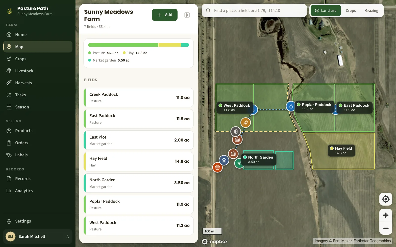
A map of your land that measures itself
Tap the corners of a field on satellite imagery and get its acres, hectares and fence length. Add the barn, the troughs, the gates and the fence lines.
Farm mapping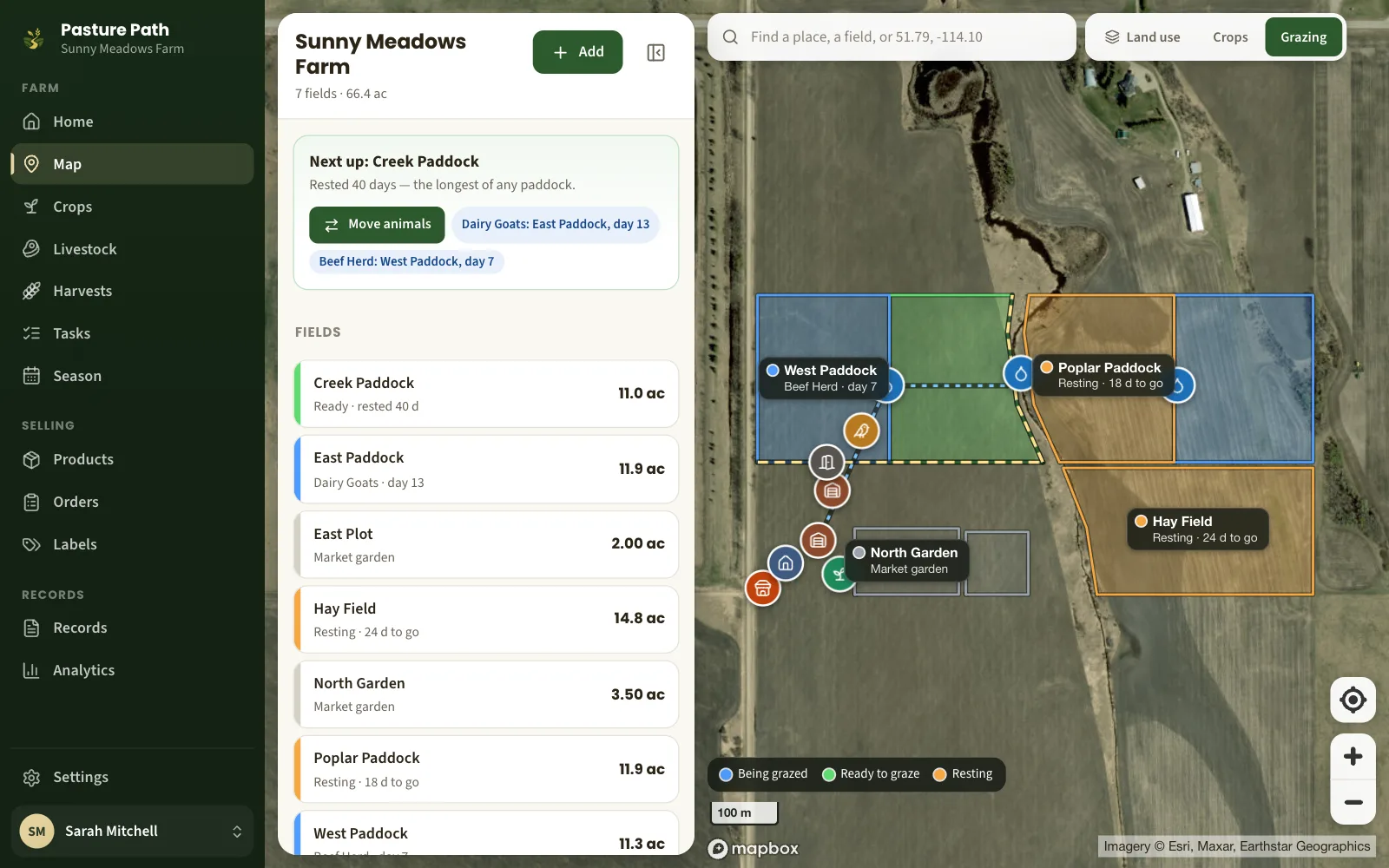
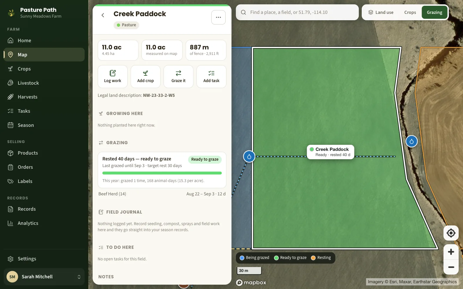
A grazing plan that keeps its own clock
Move a herd in one tap. Every paddock shows whether it is being grazed, resting or ready, how many days it has had, and which one to go to next.
Rotational grazing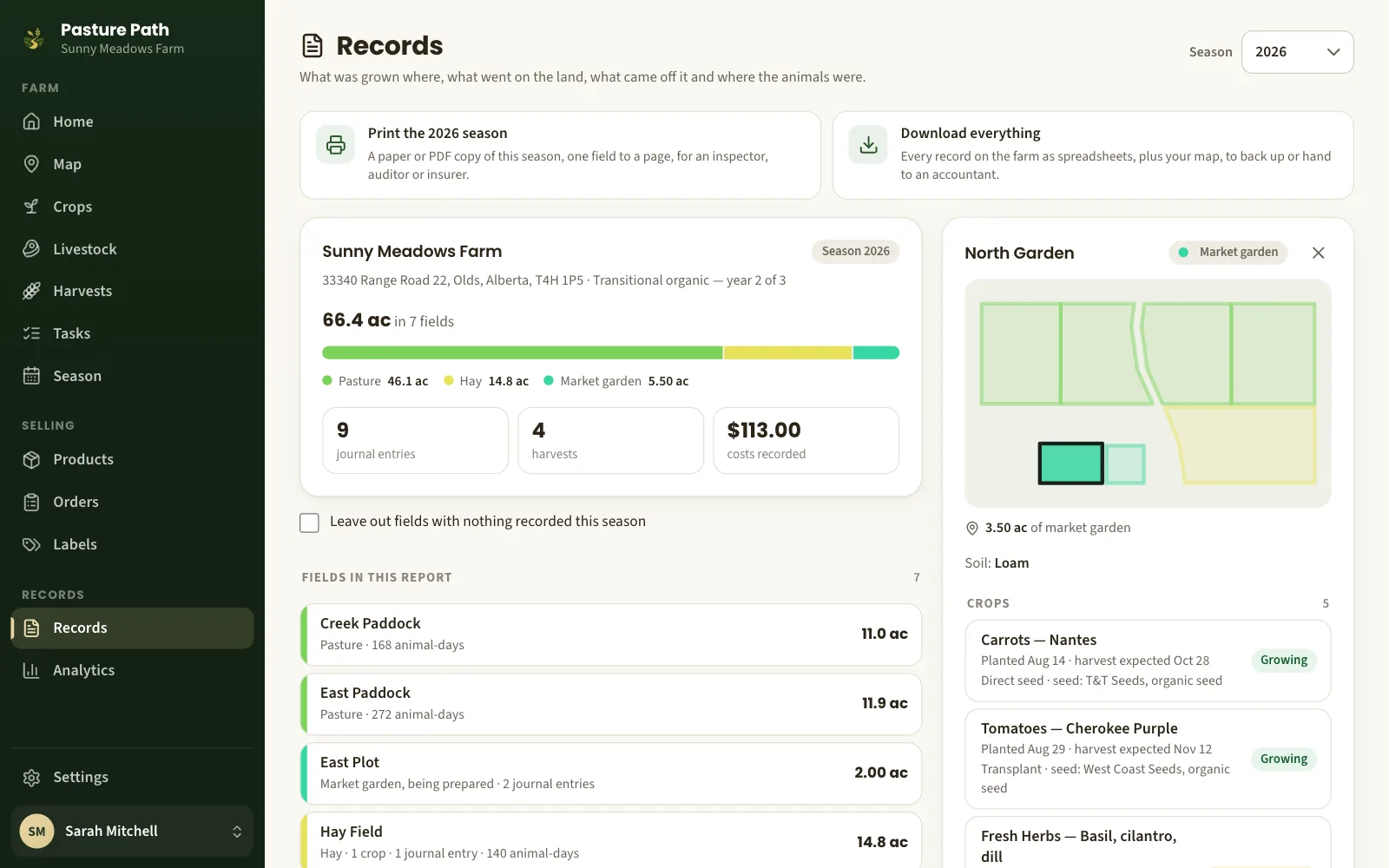
Records that are done when the season is
Log seeding, compost, sprays and field work against the field they happened on. The season report an inspector or insurer asks for is already written.
Farm records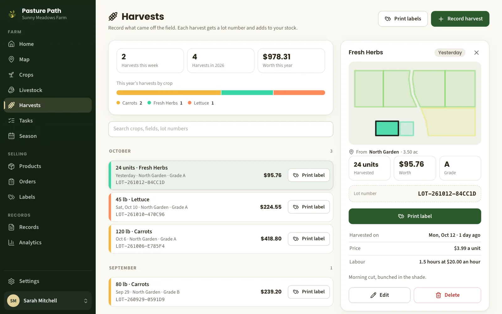
Harvests with a lot number on every crate
Record a harvest in the field, signal or no signal. It gets a lot number, a label you can print, and it goes straight onto the shelf in your inventory.
Harvest trackingBuilt for the pasture, not the office
On the phone in your pocket
Nothing to install from a store. Open it in the browser, add it to your home screen, and it behaves like an app — on any phone, tablet or computer.
Harvest logging without signal
Record a harvest at the back of the quarter with no bars. It is kept on the phone and sent, once, when you are back in range.
Acres, hectares and legal land
Areas in acres and hectares, lengths in metres and feet, and a legal land description on every field for your records.
Your records are yours
Download everything whenever you like: a spreadsheet for every kind of record, and your map as a file Google Earth can open.
Crops and livestock together
A market garden beside a beef herd beside laying hens is normal here. Fields, crops, animals and what they produce all live in one place.
Sell from the gate, if you want to
List what you have and take orders for pickup. Customers pay you at the farm; Pasture Path never touches the money. How selling works.
A small, new product that would rather show you than tell you
There is no sales call and no brochure. There is a demo farm you can walk around in right now — a mixed farm near Olds, Alberta, with paddocks, a hay field, market gardens and a herd mid-rotation — and a free account if you like it.
- Stored in Canada. Your records live on servers in Montréal.
- No lock-in. Import from Google Earth, export to Google Earth, download every record.
- Private unless you sell. Nothing about your farm is public until you list a product.
Questions farmers ask first
What does Pasture Path cost?
Nothing while it is in early access, and no card is asked for. Paid plans will come later; we will tell every farm the price well before anything changes, and you can download all your records at any time.
Does it work on my phone?
Yes. It runs in the browser on a phone, tablet or computer, and can be added to your home screen like an app. The screens are built for a thumb, in a pasture, with gloves on.
What happens when there is no signal?
Harvests can be recorded without a connection; they are kept on the phone and sent when you are back in range. The other screens show what was last loaded, but need a connection to save changes and to load map imagery.
Can I bring in field boundaries I already have?
Yes. Import a KML file from Google Earth or a GeoJSON file from other farm software, pick which shapes are fields, and they are on your map. You can download your map the same way.
Who can see my farm?
Only you. Nothing about your farm is public unless you choose to sell through Pasture Path and list a product with a price — then shoppers see the farm page you write, not your records.
Can I get my records out again?
Yes, all of them, whenever you like: one download with a spreadsheet for every kind of record and your field boundaries as a map file that opens in Google Earth and other farm software.
Is it only for farms in Canada?
No. It was designed for farms in Western Canada first, so it speaks acres and hectares, legal land descriptions and Canadian dollars — but it works anywhere there is satellite imagery, and each farm keeps its own time zone.
Put your farm on the map
Free while Pasture Path is in early access. No card, and your records are yours to download whenever you like.