 Pasture Path
Map your fields, paddocks, fences and water points
Tap the corners of a field on satellite imagery and Pasture Path gives you its acres, its hectares and the length of fence around it — then keeps everything that happens on that field with it.
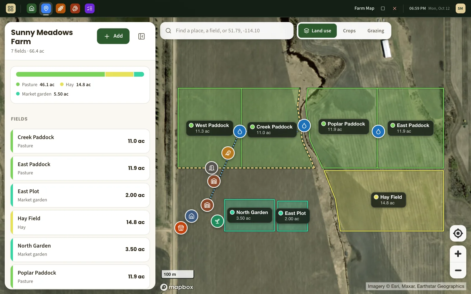
Tap the corners. Read the acres.
Find your land by searching for a place, an address or a pair of coordinates. Tap each corner of the field in turn and the acreage counts up as you go. Drag a corner to move it, tap a small dot to add one, undo the last one. When it looks right, give the field a name.
- Area in acres and hectares, fence line in metres and feet.
- Measured on the true shape of the earth, so a quarter section comes out as a quarter section — not a third of an acre short.
- Keep the acreage you go by on paper (title, lease, insurance) alongside what the map measures.
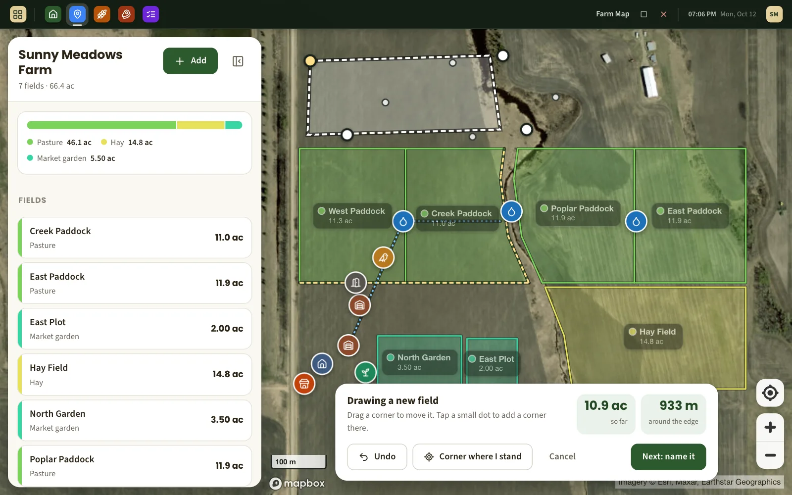
Stand on the corner if the photo is out of date
New fence, old imagery? Walk to the corner post and tap Corner where I stand. The phone's GPS drops the corner where you are, and tells you when the fix is too rough to trust so you can nudge it.
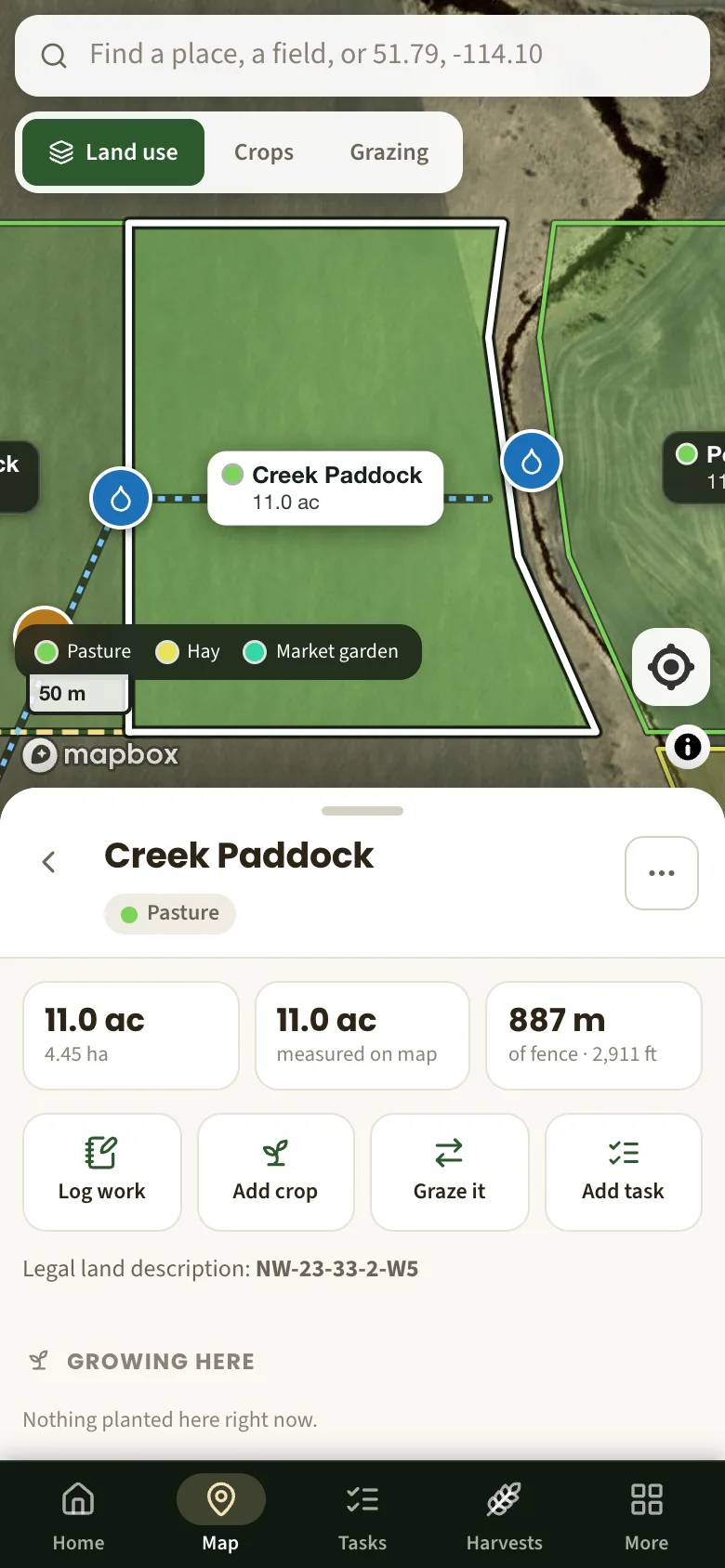
Everything else that is out there
A farm is more than its fields. Mark the barn, the coop, the greenhouse, the farm stand, every water point and gate. Draw the fence lines and the water line and see how long each one is — handy the day you price out wire or pipe.
- Buildings, water points, gates, hazards and the pickup spot as pins.
- Fences and water lines as lines, each with its length.
- A measuring tool for the distances you only need once.
One map, three ways of looking at it
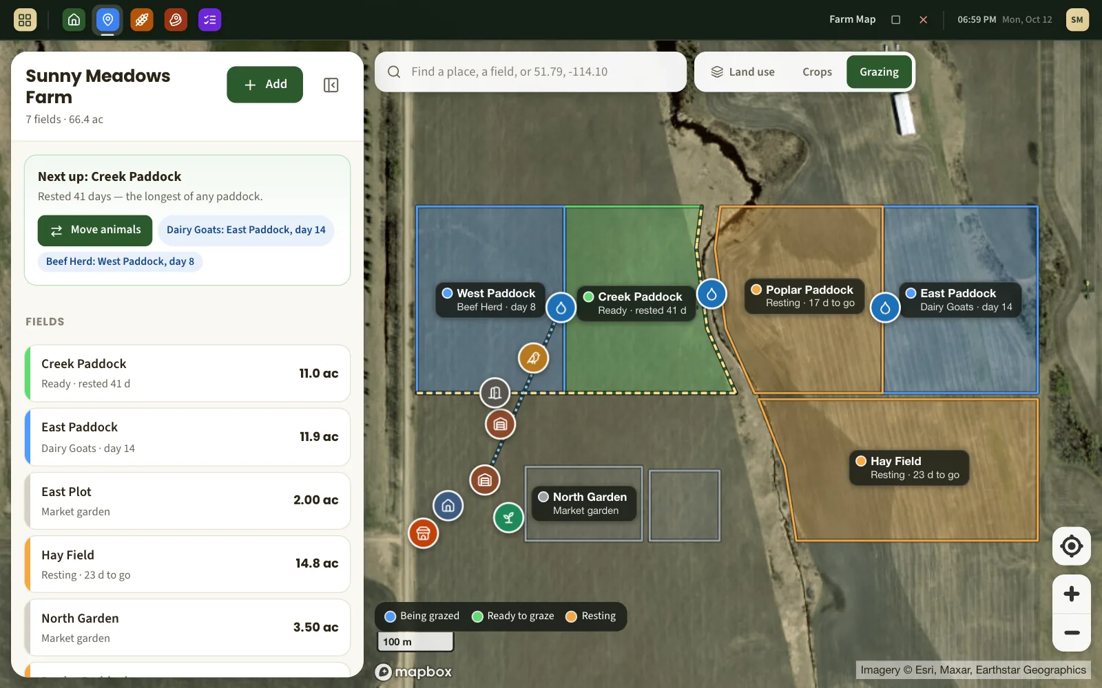
Colour the same fields by what the land is used for, by what is growing in them, or by where the grazing rotation stands. Tap any field for its own page: its crops, who is grazing it, its journal and the jobs still to do there.
Bring what you have. Take what you make.
Already drew your fields in Google Earth, or have a file from other farm software? Import the KML or GeoJSON, choose which shapes are fields, and they are on the map. Your whole map downloads the same way, any time.
- A legal land description on each field (for example NW-23-33-2-W5), printed on your season records.
- Import and export in KML and GeoJSON — the formats Google Earth and most mapping tools read.
What the map does not do
- It does not draw a quarter section from its legal land description. You draw the boundary; the description is kept beside it.
- It is not a survey. The arithmetic is exact; the result is as good as where you put the corners and how well the imagery lines up — usually within a percent or two of a surveyed figure.
- Imagery needs a connection to load, and its date varies from place to place.
About mapping a farm
How accurate is the acreage?
The calculation itself is accurate to a few parts per million. What limits it is how precisely the corners are placed and how well the satellite image is lined up with the ground, which is usually within a few metres. For a 40-acre field that is well under one percent. It is not a legal survey.
Can I import my fields from Google Earth?
Yes. In Google Earth, right-click the folder with your fields and choose "Save Place As", pick KML, and import that file. GeoJSON files from other farm software work too.
Does it work on a phone in the field?
Yes. Drawing works with a finger, and the "Corner where I stand" button uses the phone's GPS. The imagery needs a data connection to load.
Can I measure a field without making an account?
Yes — the free acreage calculator uses the same map and the same maths. An account is only needed to save what you draw.
How many fields can I map?
As many as you have. There is no limit on fields, acres or map features.
What else Pasture Path does
Rotational grazing
One-tap moves, a rest-day clock on every paddock, and the next paddock suggested.
Farm records
A dated journal for every field and a season report you can print or hand over.
Free acreage calculator
Measure any field on the map without an account.
See your own land on it
Free while Pasture Path is in early access. No card, and your records are yours to download whenever you like.